- Daily & Weekly newsletters
- Buy & download The Bulletin
- Comment on our articles
Related articles
Recent


Popular
New interactive map of Wallonia unveiled
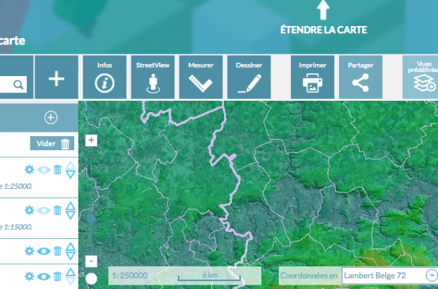
Wallonia has a new interactive portal known as WalOnMap, where users can access geographical information about the region.
The region's environment minister, Carlo Di Antonio, who launched the portal this week, described it as a "richer Google Maps".
Visitors to the site can explore an interactive map containing extensive data about each area, such as bike routes, flood zones, TEC bus stations and lines, Natura 2000 zones, and even a version of the map dating back to 1777.
Also available are the standard interactive map features such as in and out zooming, address finding, and the ability to alter types of view.
The WalOnMap intends to be of great use to professionals too, targeting the likes of planners, surveyors, scientists, foresters and mobile developers by including specific online tools necessary for the continuation or completion of their respective projects and research.
Explore the map for yourself at http://geoportail.wallonie.be/walonmap


